




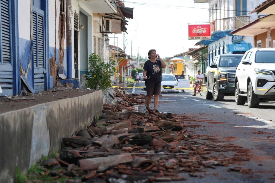
The University of Panama Geosciences Institute reported on Monday a new earthquake of magnitude 6.3 at 18: 20 (local time), located 32 km south-west of Soná and 10 km deep. The movement was perceived throughout the country and caused preventive evacuations, in the midst of a sequence initiated by the 7.5 magnitude earthquake on Friday, October 9.
Post-main earthquake activity exceeded 230 movements in the region, according to preliminary records of the Institute of Geosciences. The average frequency was one earthquake every 11 minutes, although some tremors occurred with just seconds of difference.
The 7.5 magnitude earthquake occurred at 12: 56 on Friday, October 9. His replicas were mainly concentrated in the surroundings of Tonosí, Soná and Coiba Island, while events were also recorded with reference to Santiago, Las Tablas and Chitré.
Damage to housing, schools and basic services
The emergency affected more than 700 homes and 419 educational centres, as well as road, public facilities and basic services. The problems were concentrated in sectors of Los Santos, Herrera and Veraguas, where water and electricity interruptions, along with the deterioration of the roads, made it difficult to care for families.
The communities of Macaracas, in Los Santos, and Los Pozos, in Herrera, were among the most damaged localities. In rural areas away from district headers, access difficulties delayed house assessments and the distribution of assistance.
Many families remained outside their homes because of the presence of cracks, detachment and structural damage. The uncertainty intensified during the night, when fear of new replicas prevented some residents from going back to sleep under the roof.
About 90% of the events included in the preliminary count occurred at a depth of 10 km or less. There were also records within five, four, three and two kilometres, a condition that can intensify the shocks near the epicentre, although the effects also depend on the magnitude, distance and conditions of the ground.
The system of failures that goes through the South Panamanian and the historical antecedent
The earthquake of October 9 occurred in a region crossed by the AzueroSoná Fallas System, a regional shear structure with a northeastern-southeast orientation. The Institute of Geosciences identified her as responsible for the large-scale seismic activity in Tonosí, Veraguas and in the south-west of Panama.
The system combines lateral tear failures with extension mechanisms, associated with normal and compression failures, linked to reverse failures. This diversity is reflected in the focal mechanisms recorded in its various sections, the Institute explained.
The Mariato area and the Gulf of Montijo have a combination of tear failures with normal and inverse components, he said. On and around Coiba Island, there are a predominated ulterior failure linked to the interaction between Coiba's fracture and local structures, which generate frequent seismicity with side ruptures.
La península de Azuero tiene antecedentes históricos de terremotos asociados a esa estructura. Cronistas de la época colonial registraron un sismo el 2 de octubre de 1516, considerado el primero documentado en tierra firme y sentido en toda la península.
En 1913, un terremoto con magnitud de momento estimada en 6,9 fue asociado a la falla de Tonosí. El evento provocó deslizamientos y graves daños en poblados del sur de Azuero, además de un pequeño tsunami que llegó al golfo de San Miguel, en Darién.
Panamá se asienta sobre una microplaca que abarca principalmente su territorio, Costa Rica y la franja occidental de Chocó, en Colombia, delimitada por bordes convergentes y de transformación. Esa configuración también está relacionada con terremotos registrados en Puerto Armuelles y su entorno en 1934, 1979, 2002, 2003 y 2019, además del sismo de magnitud 6,7 al sur de David en 2022.